Updates from the Central NEK 2019

Discuss Fall Foliage in Vermont, when to come, where to stay, where to take a tour etc. Note: You must be registered in order to post. If you have trouble registering, use the contact us form on Scenes of Vermont's home page.

Moderators: Andy, pwt54, admin, ctyanky

Post Reply
From_the_NEK
Posts: 377
Joined: Wed Sep 16, 2009 9:39 am
Location: Lyndonville, VT

Updates from the Central NEK 2019

Post: # 22642Post From_the_NEK
Thu Sep 19, 2019 12:57 pm

I'll be posting updated conditions in this thread for my home area here in the Lyndon area.

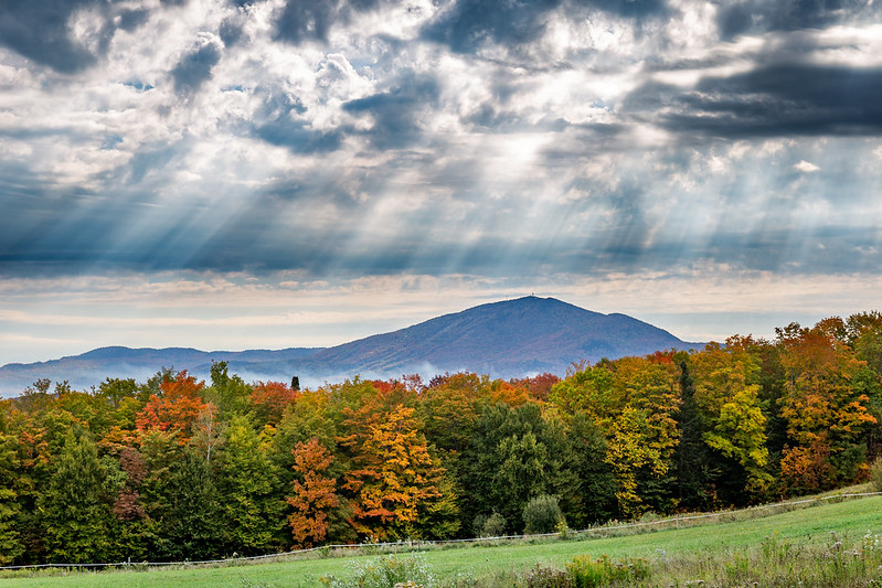
So far foliage is progressing nicely. There are some individual poppers right now. However, with the latest hard frost things should start really get going.

Photo Update for 9/19/19 (taken this morning as the fog burned off):
Image

Image

Image

-----------
I also want to give everyone easy access to this driving route post I put together a while back that hits may of the great spots around here (it is buried in the Scenic drives sticky post above along with some others if you want to see more).
From_the_NEK wrote:
Wed Sep 16, 2009 4:40 pm
Scenic Drive, DRIVING ROUTE - Loop through the central Northeast Kingdom "NEK Central"

Please keep in mind that the photos in the this driving route post were not all taken the same day (or the year for that matter). I am lucky to have visited these locations A LOT and been able to get some great photos over the years. Hopefully you are able to find some great shots of your own along the way.

Google Directions: http://g.co/maps/te5xt
Google directions without Wheeler Mtn Rd: http://goo.gl/maps/KHFa4
Google Directions without Wheeler Mtn Rd but with all optional offshoots (May Pond, Lake Willoughby South Beach, Island Pond, Burke Mtn Toll Road): https://goo.gl/maps/C54KRpQ1Ab82

Living in the Northeast Kingdom, I could go on for ever about the various routes that provide great foliage viewing. Here is one of my favorites.

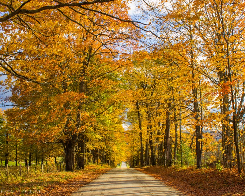
Note: This route is rather complex and involves quite a bit of gravel road driving (which in my opinion is where the best viewing is found). However, if you're up for trying it, I think you'll find it much better than traveling through the valleys of the NEK which is where the major paved roads keep you.

Distance: 60 miles
Driving Time: 2 hrs 15 minutes (obviously longer if you stop to take pictures :D )
Recommended time frame: Late September - 1st week of October

Starting point:
Lyndonville - Colonnade Inn parking lot (off exit 23 of I-91)

Take a right out of the parking lot onto the Back Center Rd (as you proceed along this road there are very nice views toward town with Burke Mtn as a backdrop, and there is also a horse ranch as well).

At the stop sign, continue straight through the intersection onto Center St (you will pass through the campus of Lyndon Institute, a semi-private high school that may have a football game in progress). You will then pass through the Miller's Run covered bridge before intersecting with VT122.

Turn left at the stop sign onto VT122 and IMMEDIATELY turn right onto Lower Pudding Hill Rd (there are a lot of good views to the East toward Burke Mtn along this road.
Image

<Optional detour>: Immediately after the airport, turn left on Airport Rd and then right on Old Coach Rd, a dead end side road off of Pudding Hill Rd 1.5 mile long detour with views like this -
Image

And this -
Image
<end optional detour>

Back on Pudding Hill Rd, at the top of the hill {3.5 miles} there are outstanding views toward Burke and to the south down the Passumpsic River valley.


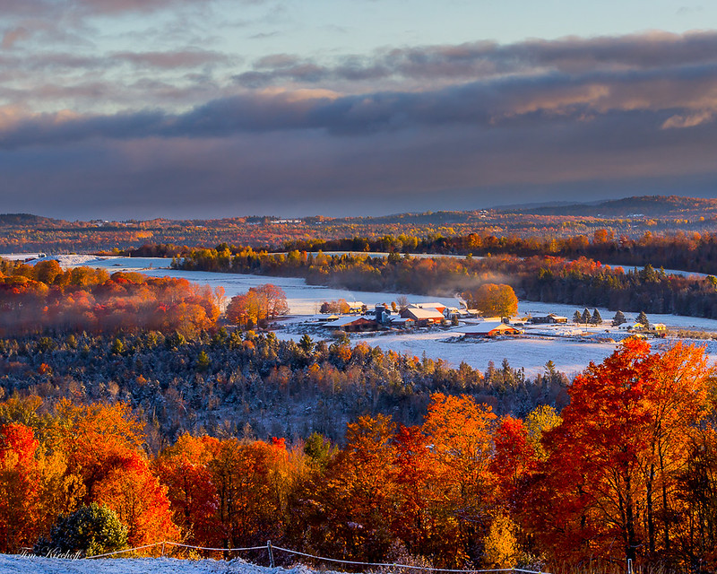
Continue on another .4 miles to a grand vista northwest to Willoughby Gap, north to hilltop farms and Bald Mtn, east to Burke Mtn.

Image

Image

Image

Just down the hill from the northerly vista, turn left onto S Ridge Rd. Bear right onto Wheelock Rd and follow it into "downtown" Sutton (keep an eye out for nice little white church). At the Fire Station, turn left onto Underpass Rd. There are multiple great vistas along this road.

Continue on Underpass Rd until it ends at US Route 5.

Turn left on US RT5.

Option:
Travel 1.6 miles and turn right on Wheeler Mtn Rd.
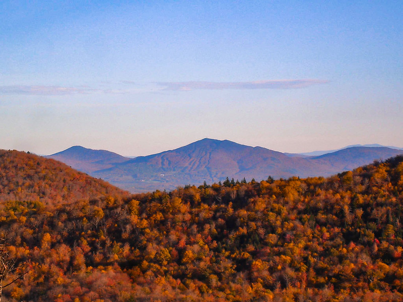
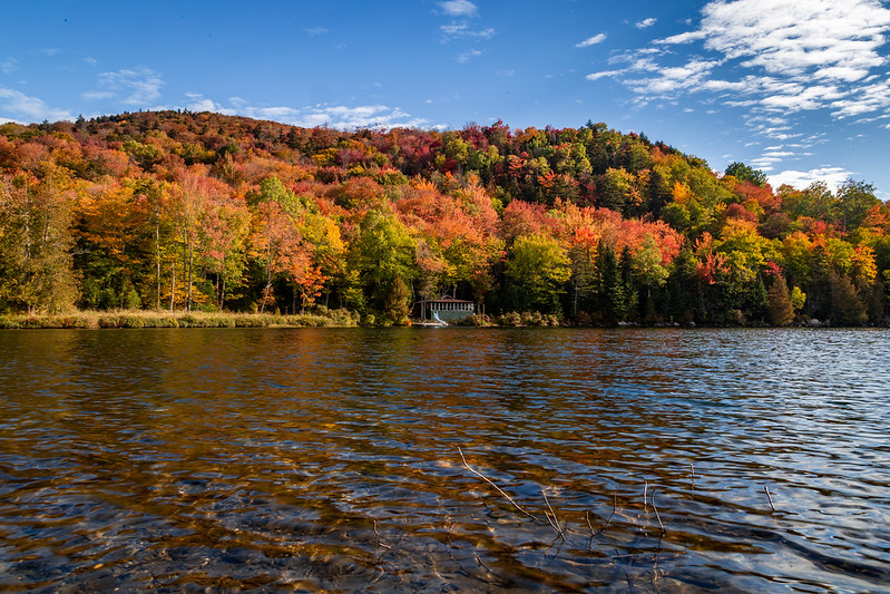
Wheeler Mtn Rd provides you with a great secluded pond and access to a great hike (Wheeler Mtn) if you wish to do so. South view from the top of Wheeler Mtn in 2007:
Image
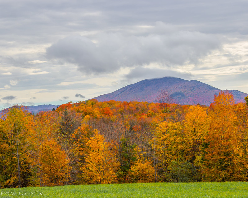
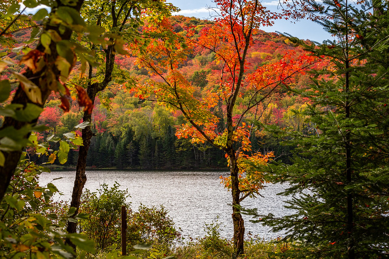
East View (Burke Mtn):
Image

[NOTE: This is a rather rough road in spots. You may want to bypass this by continuing on Route 5 to Barton.


If bypassing Wheeler Mtn, continue to Barton and turn right on VT16 (Eastern Av). This will bring you past the north end of Crystal Lake. May Pond is a nice side trip off this option as well.]

Turn Right on Cook Rd and then turn onto Peene Hill Rd.
Bear right onto N Beach Rd (VT16). This brings you to the North Beach of Lake Willoughby.

Bear right onto Route 5A for 1 mile. {Option: Follow Route 5A to the south end of Lake Willoughby for more great views, then go back north to Hinton Hill Rd}
Image

Turn Left onto Hinton Hill Rd. If it is a very clear day, at 1.6 miles up the hill, keep an eye out behind you for an amazing view stretching Southwest to Mt Mansfield and Camels Hump. Bear left to stay on Hinton Hill Rd.

Bear Left onto Westmore Rd for 1.2 miles

Turn Right on Hudson Rd for .3 miles

Turn Right on VT105 for 3.2 miles
(Option: stay on 105 for a couple of miles if you want to go to Island Pond. Return to the main route the way you came.).

Turn Right on VT114 for .75 miles

Turn Right on Newark Rd. This will become Abbott Hill Rd and then Newark St. Look for the Jobs Pond turn off on the right 3.25 miles up the road.

11 miles after turning onto Newark Rd, turn left onto Sugarhouse Rd where you will immediately be in the middle of a sugarbush.
Image

Continue for 2.1 miles and bear left onto Burke Hollow Rd for .65 miles.

Turn Right onto Darling Hill Rd (at the top of the hill) for 5.6 miles. You will pass several attractive Inns and farms along this very scenic ridgeline.
(option: Burke Mtn Toll Road ($5 per car). After a couple of miles on Darling Hill Rd, keep your eye out for East Darling Hill Rd on your left. Take this down the hill into East Burke Village and head up toward Burke Mtn. Return to the main route on Darling Hill the way you came.).

Turn Right onto VT114 for .5 miles

Turn Left at the light onto US Route 5 for 2 miles. Keep an eye out on your right for the park in the middle of town. This can have good foliage later in the season if the hills are already past. Arrive at your starting point, the Colonnade Inn, is on your right.


Please note there are so many options off of this route it is hard to list them all. The Burke Mtn Toll Rd provides outstanding views across northern Vermont and New Hampshire from the fire tower. The road is paved to the the summit and the fire tower is a .2 mile walk from the parking lot. This is recommended if the morning is very foggy. Often an early morning drive up the toll road can get you up above the low level fog for some beautiful views.

Edited: 8/20/10 fixed picture link and updated Burke Mtn toll road price
Edited: 9/27/11 for revised content and photos
Edit: 9/11/13 for content and added Google direction that route around Wheeler Mtn Rd
Edited: 8/17/16 for revised content and photos
Edited: 9-19-19 to fix photos links that Photobucket broke
Last edited by From_the_NEK on Thu Sep 19, 2019 1:56 pm, edited 3 times in total.


ctyanky
Board Admin
Posts: 3322
Joined: Tue Jul 24, 2007 7:22 am

Re: Updates from the Central NEK 2019

Post: # 22643Post ctyanky
Thu Sep 19, 2019 1:09 pm

Geezum crow! this is the most outstanding post I've seen on this forum! You are invaluable! So appreciative of the time you put into this and will look forward to your updates! Mostly, sharing your love for VT and the NEK is truly remarkable. Thank you, thank you, thank you!!!!! :D :D :D

ctyanky
Board Admin
Posts: 3322
Joined: Tue Jul 24, 2007 7:22 am

Re: Updates from the Central NEK 2019

Post: # 22644Post ctyanky
Thu Sep 19, 2019 2:10 pm

Tim: where is the trailhead for Wheeler Mtn. I've been on that road. Can't remember a sign for the hike?

From_the_NEK
Posts: 377
Joined: Wed Sep 16, 2009 9:39 am
Location: Lyndonville, VT

Re: Updates from the Central NEK 2019

Post: # 22645Post From_the_NEK
Thu Sep 19, 2019 3:07 pm

ctyanky wrote:
Thu Sep 19, 2019 2:10 pm
Tim: where is the trailhead for Wheeler Mtn. I've been on that road. Can't remember a sign for the hike?
It is about 1 mile past Wheeler Pond on the left side of the road. Look for it after you pass the two houses that are on the right.

kcflanders
Posts: 54
Joined: Thu Sep 18, 2014 1:08 pm

Re: Updates from the Central NEK 2019

Post: # 22654Post kcflanders
Fri Sep 20, 2019 6:46 am

From_the_NEK wrote:
Thu Sep 19, 2019 3:07 pm
ctyanky wrote:
Thu Sep 19, 2019 2:10 pm
Tim: where is the trailhead for Wheeler Mtn. I've been on that road. Can't remember a sign for the hike?
It is about 1 mile past Wheeler Pond on the left side of the road. Look for it after you pass the two houses that are on the right.
The trailhead is now on the right side of the road. It has a nice information sign with all of the trails in the area. You walk thru the woods a little bit and then it crosses the road. It was moved due to private property concerns, so is now a bit longer of a hike.


ctyanky
Board Admin
Posts: 3322
Joined: Tue Jul 24, 2007 7:22 am

Re: Updates from the Central NEK 2019

Post: # 22659Post ctyanky
Fri Sep 20, 2019 9:29 am

Hi Tim and KC: thank you both for your input on the Wheeler trailhead. I found this link confirming the new trail and why it happened. It is a good article. Why can't people respect the easements provided by private land owners? This is disturbing, "The decision to relocate the lower Wheeler Mountain Trails was precipitated by chronic issues of high traffic, illegal fires, unauthorized camping, vandalism, and inadequate parking. Much of Wheeler Mountain is on private land." Hikers are lucky they didn't close it for good! Not to mention disrespect for our natural environment! I hope this does not occur on the new trail. :(

http://www.northwoodscenter.org/wordpre ... -mountain/

Anyways, it is a nice new trail map. CT

From_the_NEK
Posts: 377
Joined: Wed Sep 16, 2009 9:39 am
Location: Lyndonville, VT

Re: Updates from the Central NEK 2019

Post: # 22690Post From_the_NEK
Mon Sep 23, 2019 2:49 pm

UPDATE, Monday 9/23/19:
Well thinks have certainly progressed quickly here in the NEK. Last weeks frost really spurred on the color change and we are approaching peak conditions. This coming weekend should be great. Perfect for the East Burke Fall Foliage Festival.

Here are some photos from Lyndonville and Sutton, VT. Today is still warm and very humid so there is quite a bit of haze in the air which mutes the colors a bit.

Image

Image

Image

Image

ctyanky
Board Admin
Posts: 3322
Joined: Tue Jul 24, 2007 7:22 am

Re: Updates from the Central NEK 2019

Post: # 22691Post ctyanky
Mon Sep 23, 2019 2:59 pm

OMG Tim! Thank you! I timed this trip perfectly and I can't wait! I'll be up in 3 days! Will you be at the Burke Festival? My friends and I will be there most of the day! I'm getting there early! Thanks for these gorgeous photos!!!! :D :D :D

From_the_NEK
Posts: 377
Joined: Wed Sep 16, 2009 9:39 am
Location: Lyndonville, VT

Re: Updates from the Central NEK 2019

Post: # 22731Post From_the_NEK
Thu Sep 26, 2019 2:46 pm

FOLIAGE REPORT
Thursday 9/26/19:
The NEK is coming into peak form. There is still green out there. Many birches have yet to change. By this weekend and next week, anyone coming to the area should have a GREAT show.

Here are some photos.

The first 3 are Lyndonville area from yesterday evening.

Image

Image

Image

Sutton and Westmore this morning (light quality was highly variable this morning but it was still beautiful).

Image

Image

Image

ctyanky
Board Admin
Posts: 3322
Joined: Tue Jul 24, 2007 7:22 am

Re: Updates from the Central NEK 2019

Post: # 22733Post ctyanky
Thu Sep 26, 2019 3:20 pm

Wow Tim, these photos are getting me light headed! Thanks for sharing. Just amazing. You are a terrific photographer! :D

From_the_NEK
Posts: 377
Joined: Wed Sep 16, 2009 9:39 am
Location: Lyndonville, VT

Re: Updates from the Central NEK 2019

Post: # 22804Post From_the_NEK
Mon Sep 30, 2019 2:13 pm

Update: 9/30/19

If you're not here, get here soon. The foliage is peaking right now. However, with the upcoming forecast full of rain, I don't think the current leaves will hang on long enough for it all to come together as it has the past couple of years. The birches are still mostly green which means, in my opinion, most hillsides won't get to that mind-blowing explosion of color.

Don't get me wrong, it is still great out there.

Saturday after the rain (CT will like this one :D )
Image

This morning, Sheffield Heights area:
Image

Image

Image

From_the_NEK
Posts: 377
Joined: Wed Sep 16, 2009 9:39 am
Location: Lyndonville, VT

Re: Updates from the Central NEK 2019

Post: # 22844Post From_the_NEK
Thu Oct 03, 2019 5:31 pm

Update Thursday 10/03/2019: The NEK (northeastern Vermont) is still going strong. I got a bit carried away in the hills of Sheffield, Wheelock, and Sutton today (close to 700 photos that are going to take me weeks to go through).

Class 4 roads can lead to some great spots! I managed to find some extremely rough and wet ones that I hadn't been on since back roading with friends when I was in high school. :lol: :D

We survived the heavy rain earlier in the week and hopefully we get a bit of mountaintop frosting tonight!

ImageRough Road-0718 by Tim_NEK, on Flickr

ImageTree Tunnel-0701 by Tim_NEK, on Flickr

ImageSheffield Farm Tree-0819 by Tim_NEK, on Flickr

ImageBurke Sheffield Farm-0922 by Tim_NEK, on Flickr

ctyanky
Board Admin
Posts: 3322
Joined: Tue Jul 24, 2007 7:22 am

Re: Updates from the Central NEK 2019

Post: # 22850Post ctyanky
Thu Oct 03, 2019 6:36 pm

Tim: great photos! Glad the NEK is still going strong! Good news for the leaf peepers! What a season, so much beauty everywhere, we are so fortunate to be up here (those living here too) to experience the colors Mother Nature had opened up for us! Thanks for sharing! BTW, loved the horse shots! :D :D


Post Reply